• Home
  • Projects
  • About
  • Contact
Adventure & Research Collective
  • Home
  • Projects
  • About
  • Contact
Team of Scientists with skis and pulkas

THE GREENLAND PROJECT

A research journey across the Greenland ice sheet

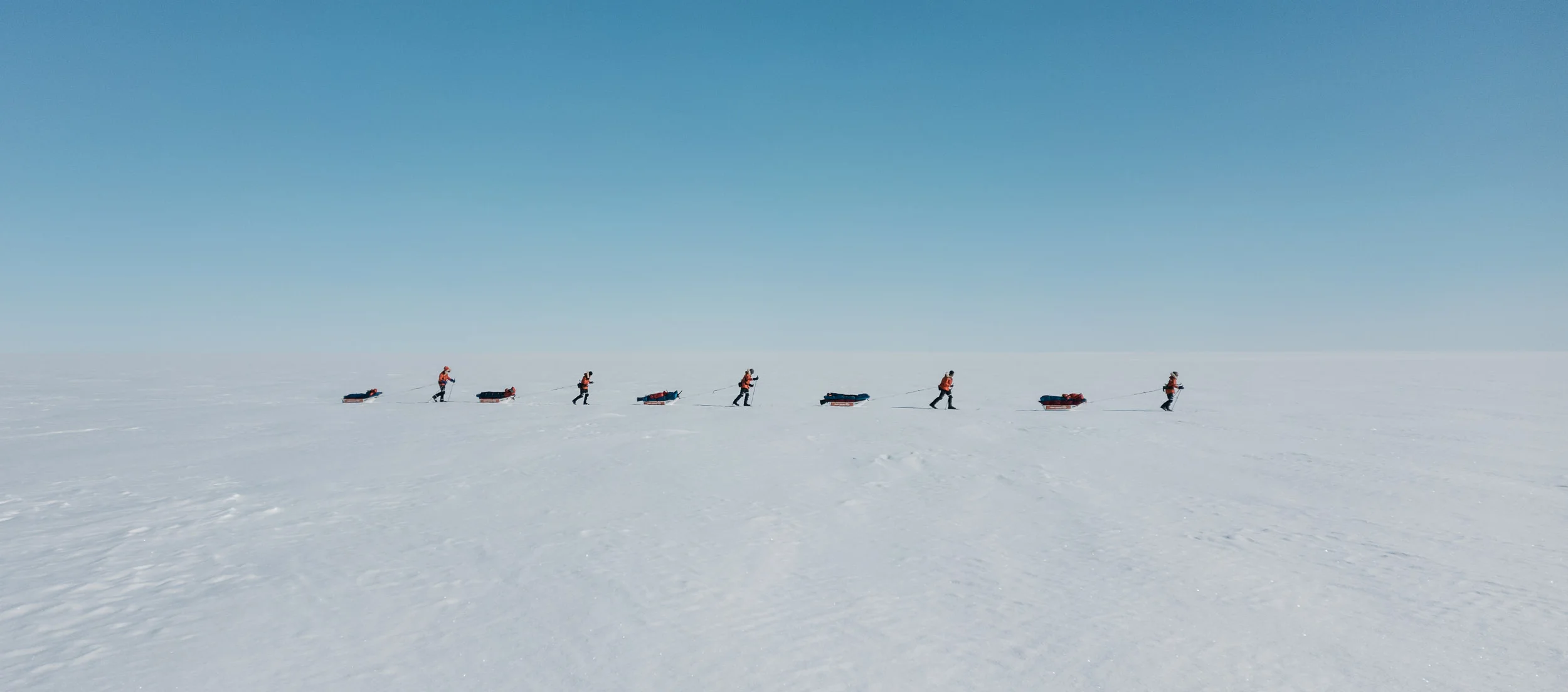
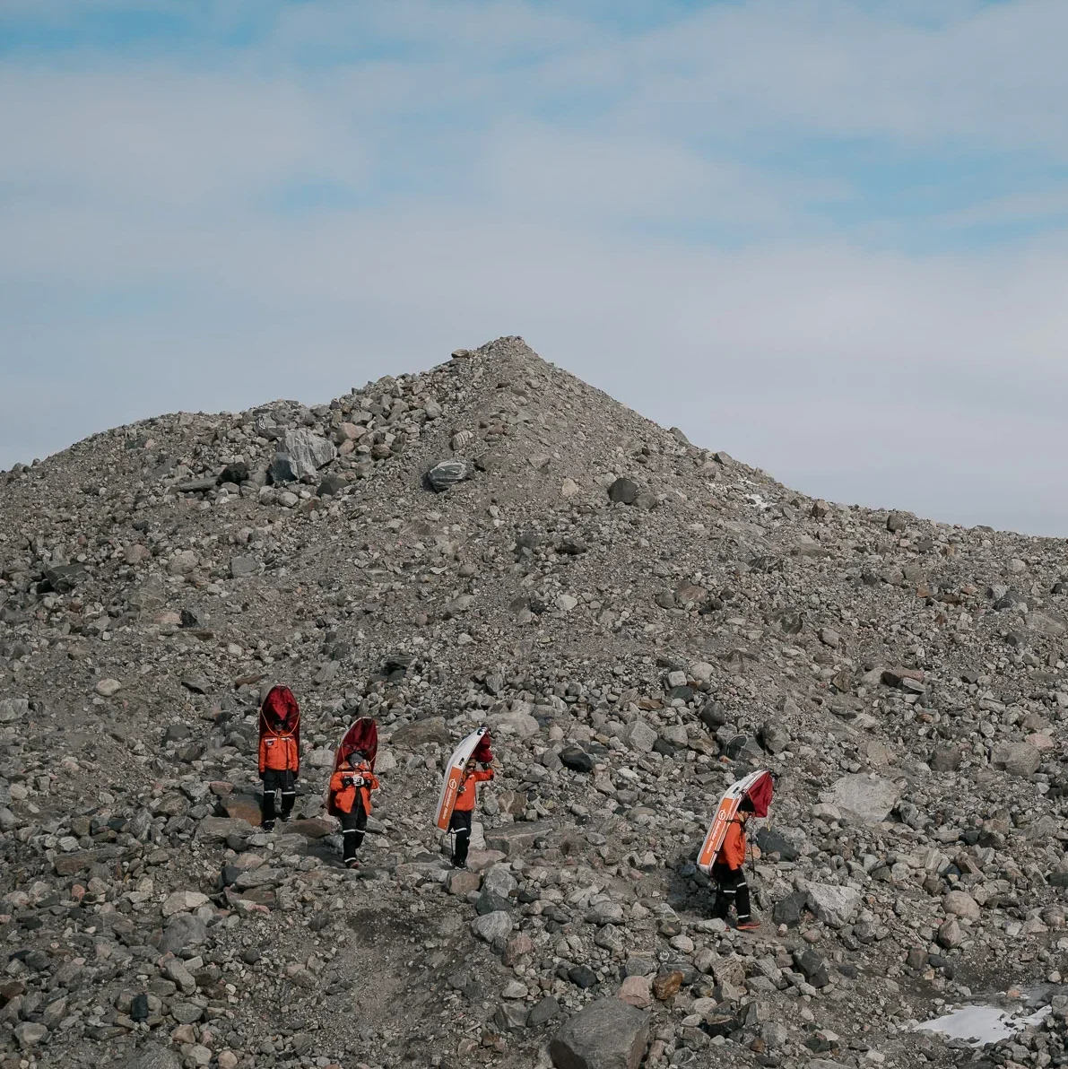
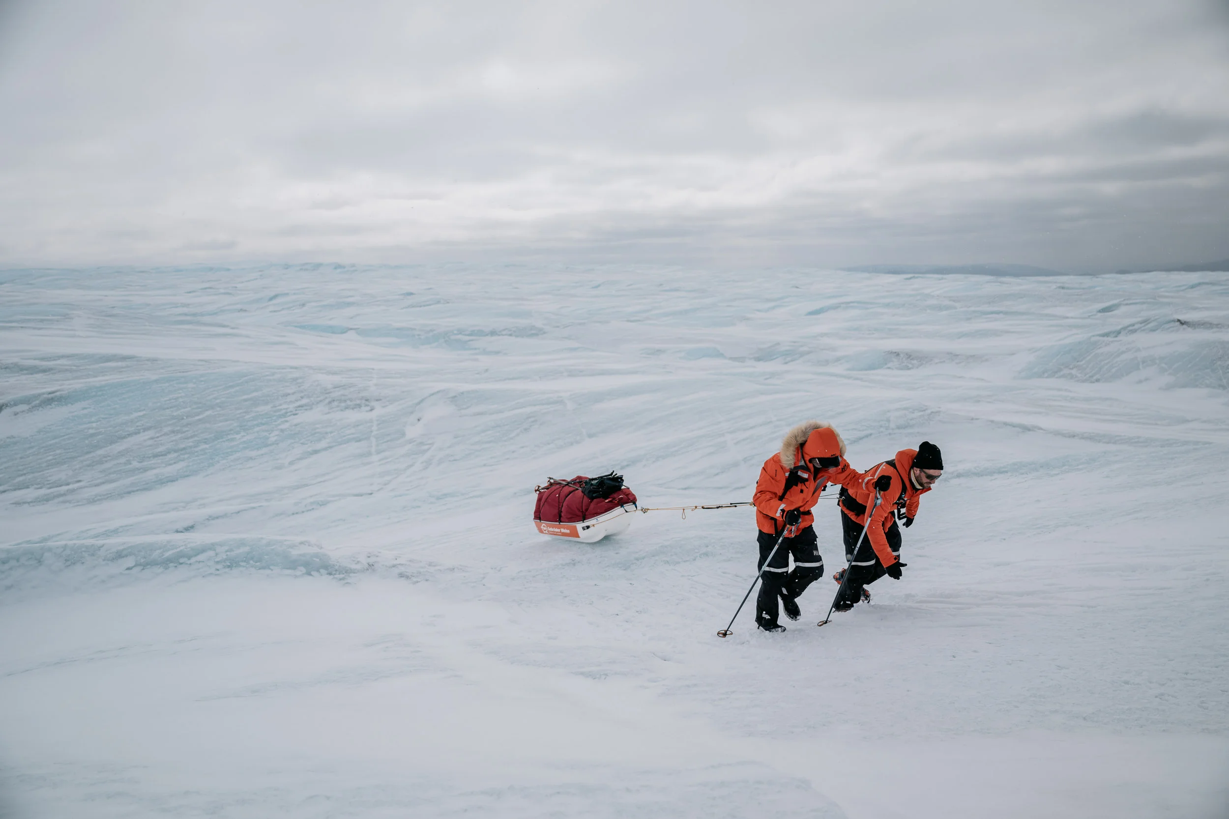
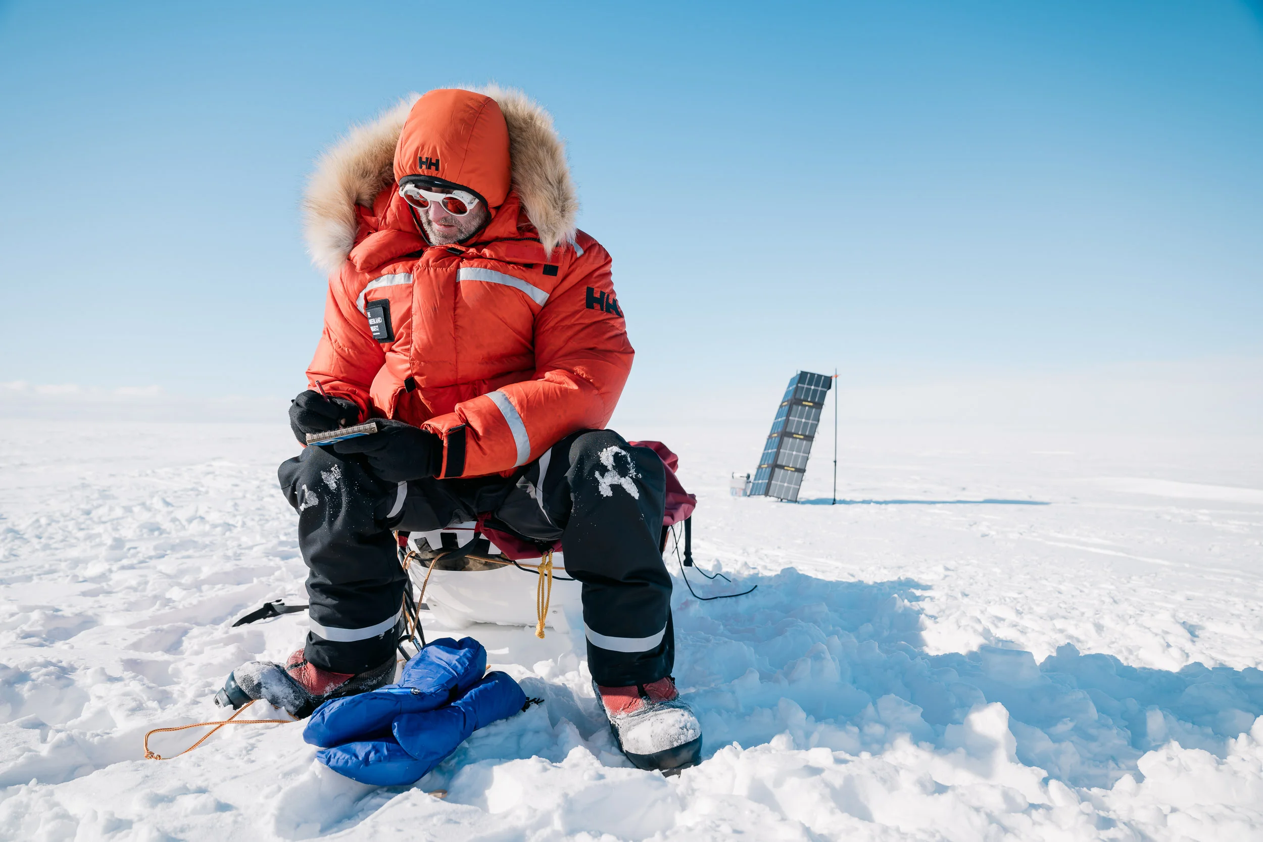
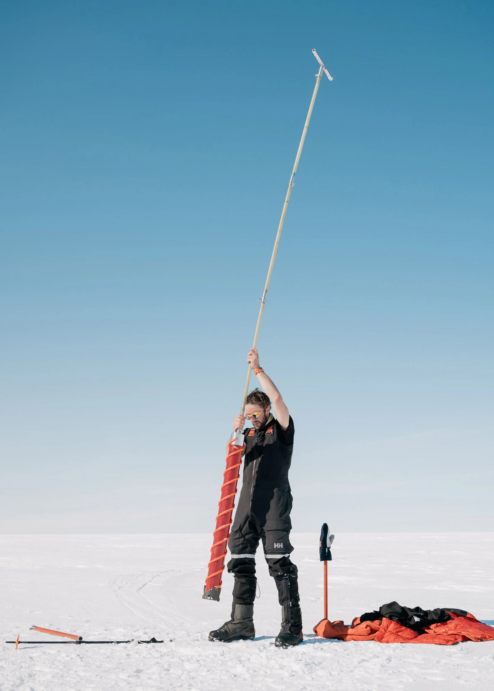
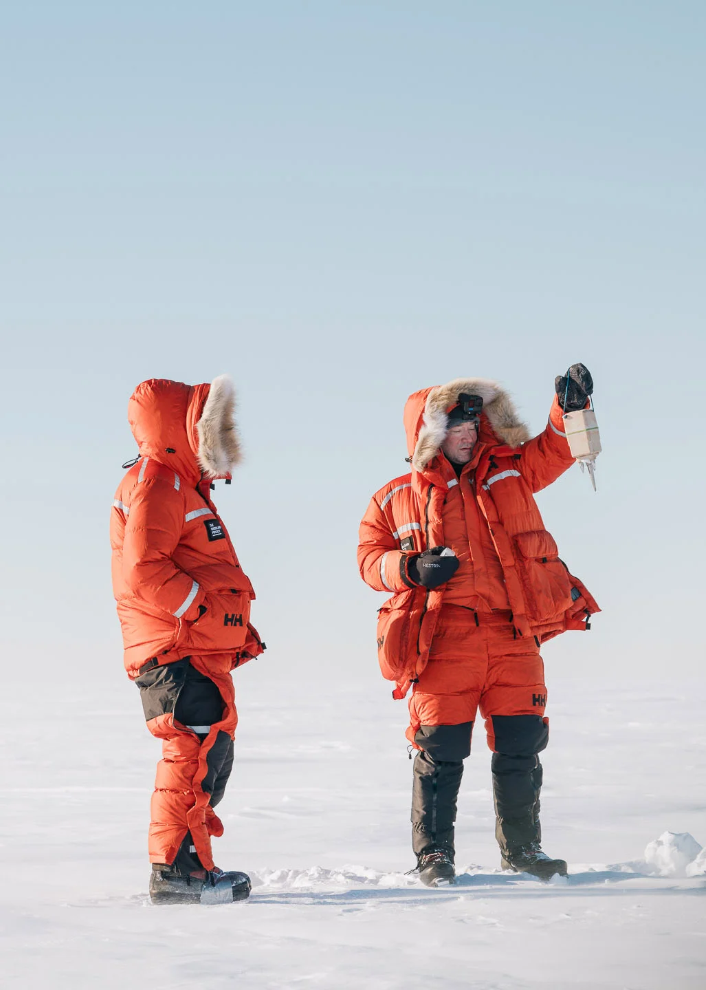
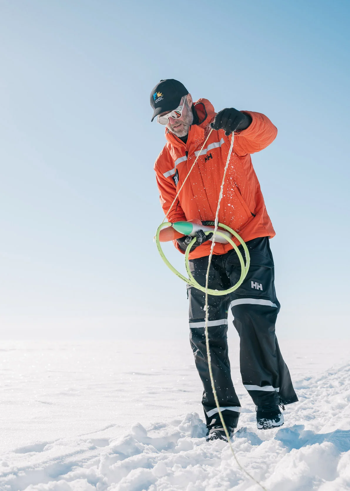
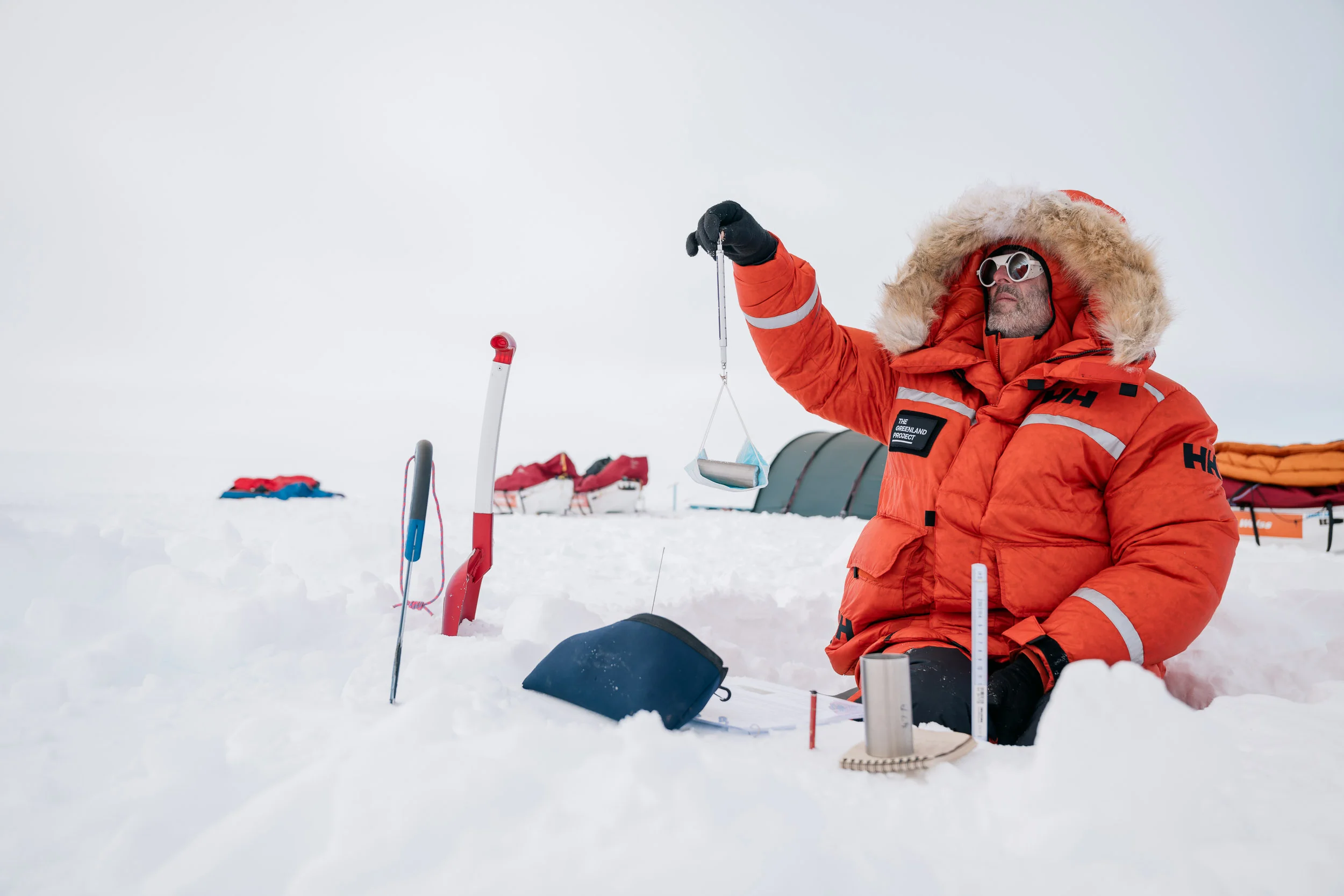
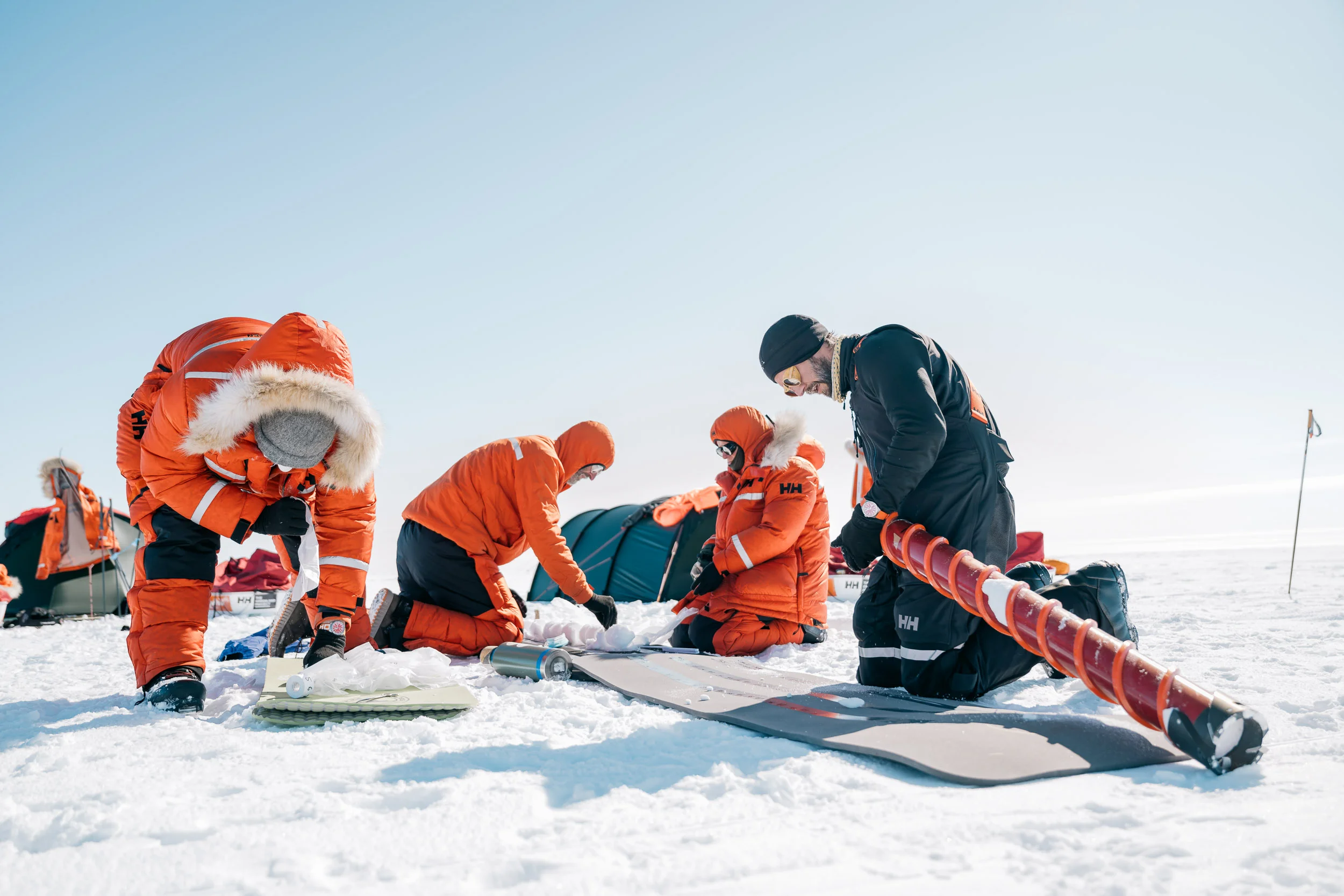
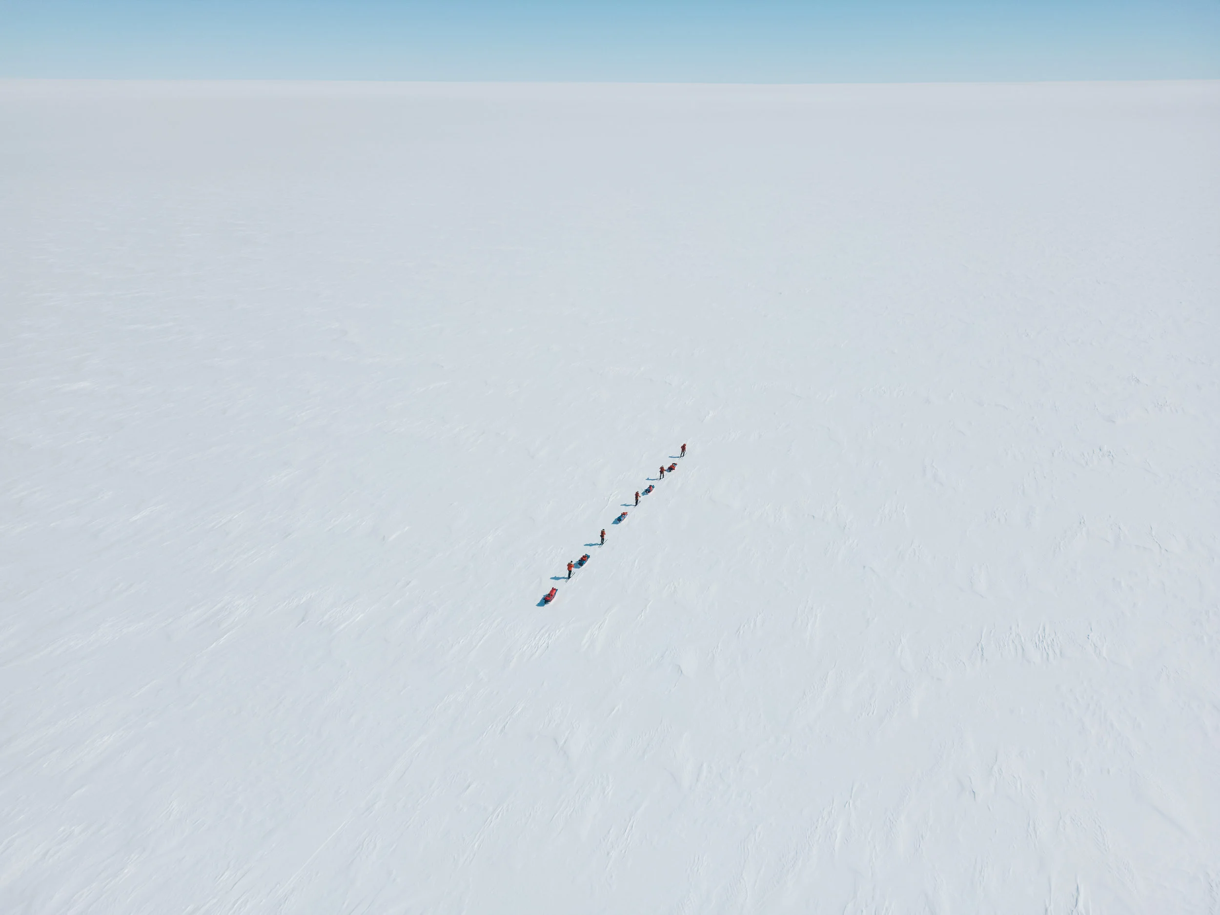
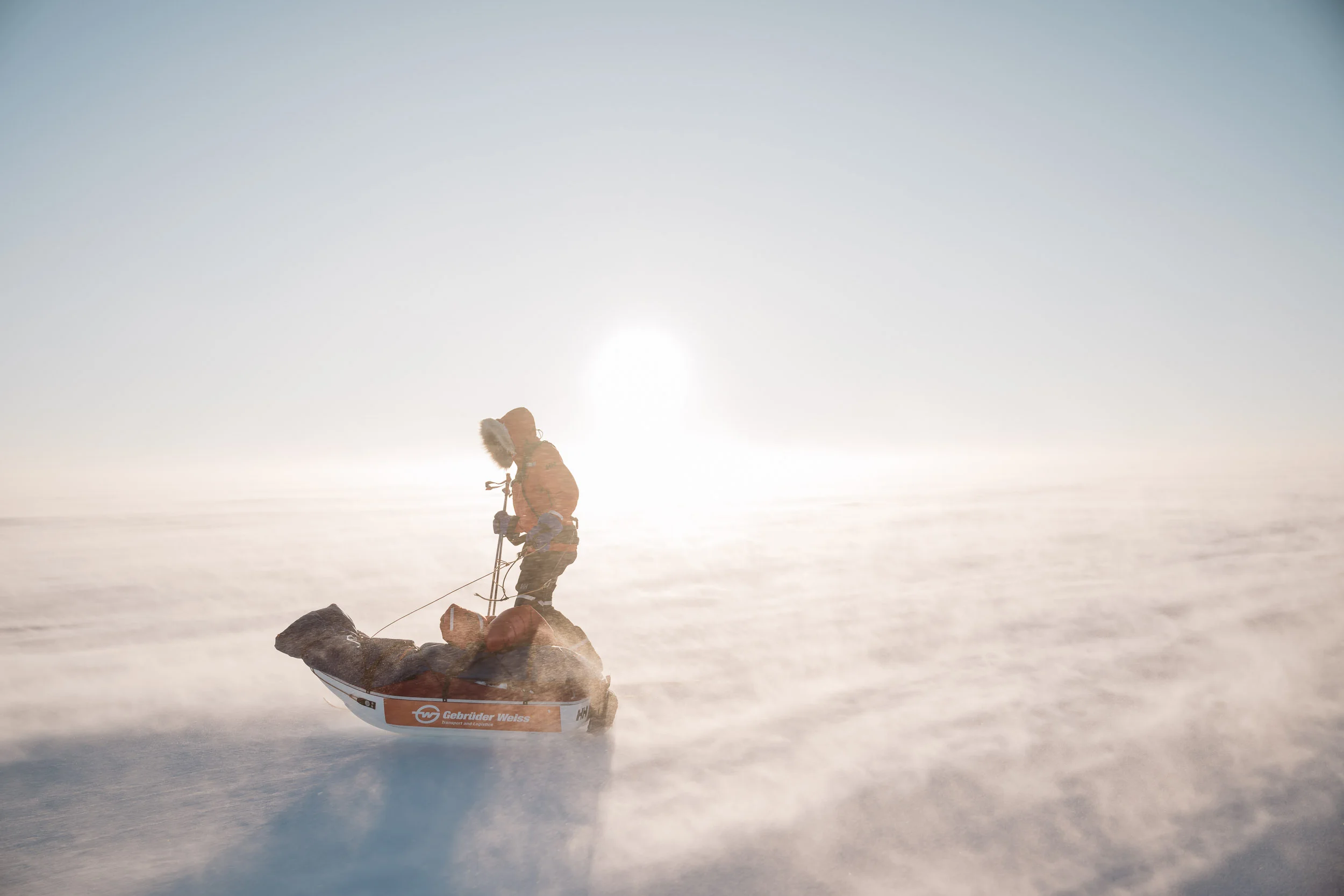
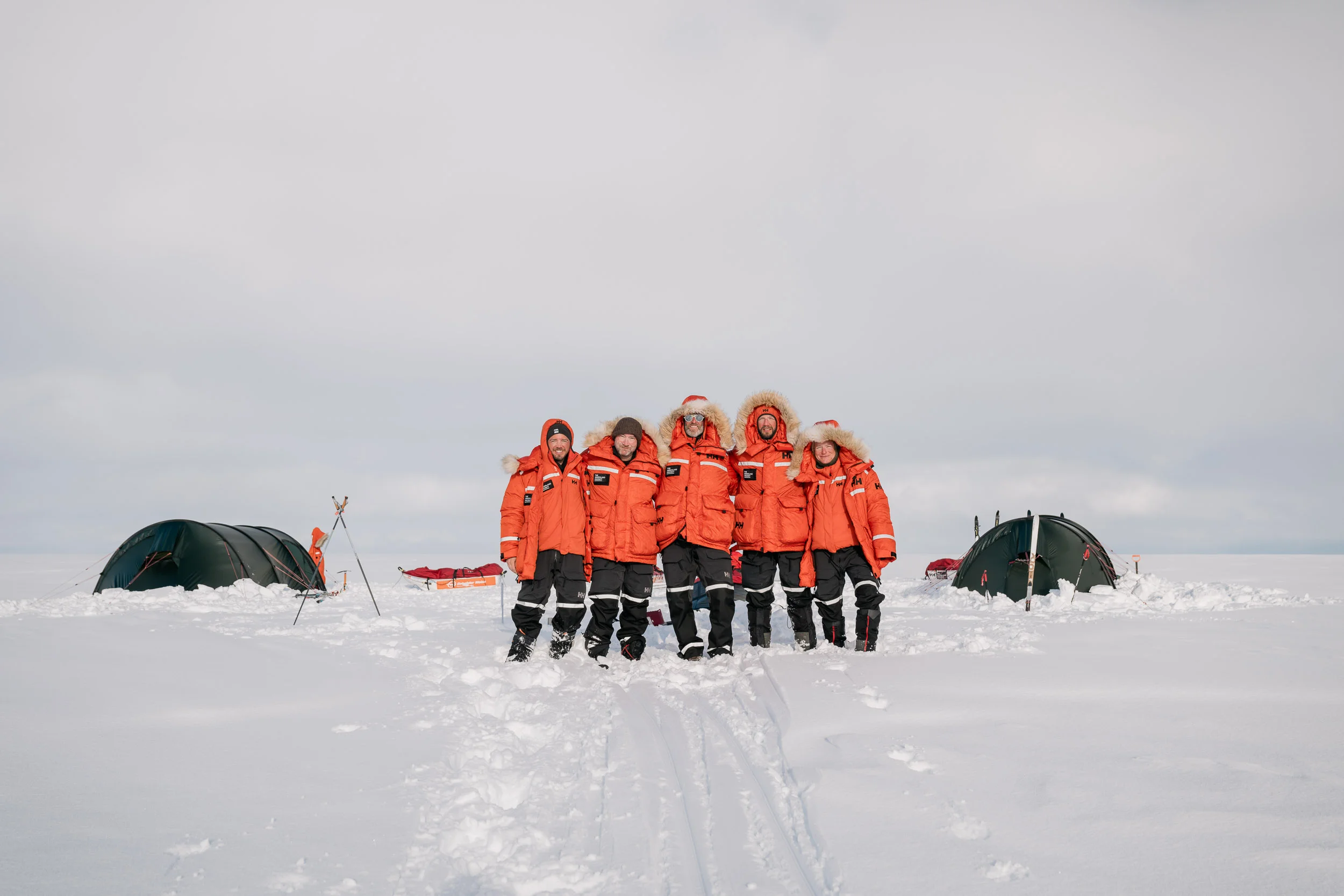
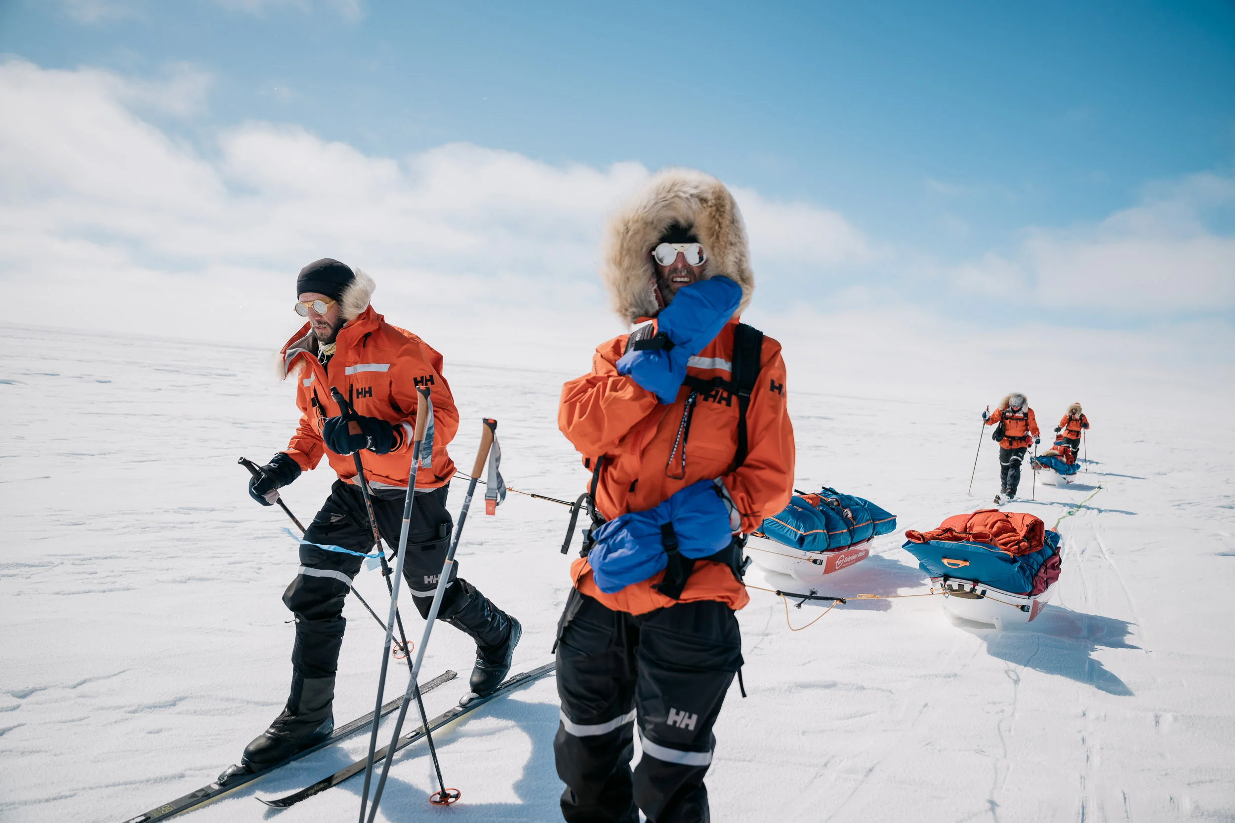
From May 1 to June 1, 2024, our international team of five completed a 580-kilometer traverse across the Greenland Ice Sheet, traveling from Kangerlussuaq to Isortoq. Moving entirely unsupported on skis, we hauled nearly a ton of equipment and provisions across the ice.

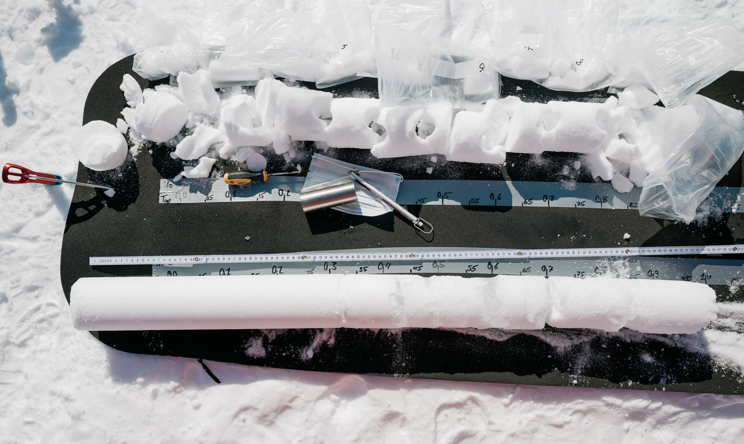
Under the scientific lead of Dr. Adrian McCallum and the University of the Sunshine Coast, the expedition focused on gathering rare physical data for several research institutes. This fieldwork provides essential “ground-truth” evidence used to verify satellite observations. By refining these data sets, the project aims to improve our understanding of the ice sheet’s current shifts and the long-term implications of a melting Greenland on global sea levels.


Research Areas

  • Surface Elevation Data
  • Ground Penetrating Radar (GPR) Data
  • Snow density measurements
  • Passive Seismic Dat
  • Firn Core

Year

  • 2024
A group of scientists crossing ice on skis with pucks behind them

Our plan was straightforward: the team met in Kangerlussuaq, Greenland’s main hub and our official starting point. A friend drove us by 4×4 to the Russell Glacier, but the easy ride ended there. We had to haul a ton of gear across two kilometers of rugged scree just to reach the edge of the ice.

From that point on, it was a four-week push across the sheet. Our days were a grueling cycle of skiing for ten hours while navigating crevasses and storms—all while keeping a sharp lookout for polar bears. On top of the physical trek, we conducted our research every morning and evening. It was an exhausting pace, to say the least.

people carrying sleds on their backs over stones
two scientists pulling a supply sled across a glacier

While we all joined for different reasons, we were immediately united by two things: a sincere commitment to the environment and the challenge of solving a complex problem. Our diversity wasn’t an accident; we were brought together specifically because our different backgrounds made us stronger. We operated on the belief that a well-rounded team consistently outpaces the efforts of any individual.

The results surpassed our expectations, and I believe our approach serves as a great model for any team. By defining clear roles based on each person’s specific strengths, we avoided the friction of “too many cooks in the kitchen.” This allowed everyone to take ownership of their work, ensuring that every team member felt—and actually was—essential to our success.

Dr. Adrian McCallum
Dr. Adrian McCallum, Glaciologist at the University of the Sunshine Coast (Australia)
Laura Balslev
Laura Balslev, Scientist at the Greenland Institute of Natural Resources (Greenland)
Jan Rasmussen
Jan Rasmussen, Expedition leader (Denmark)
Niklas Marc Heinecke
Niklas Marc Heinecke, photographer and filmmaker (Germany)
Jens Larsson
Jens Larsson, Surgeon and Medic (Sweden)
Scientist sitting on sled, making notes

The overall question/purpose was to gather hard to collect physical data from the ice sheet that will enable ground-truthing of satellite data. These insights will aid understanding of changes to the Greenland Ice Sheet, which will ultimately lead to better understanding of implications of a (future) melting Greenland Ice Sheet.

Researcher holding ice corer on glacier
Scientist holding passiv seismic tool
Scientist collecting GPR hose

Surface Elevation Data

To gather the data, we mounted a GNSS receiver to one of our sleds. These surface elevation measurements were collected to validate or ‘ground truth’ satellite-derived elevation estimates. While real-time satellite data are essential for monitoring the Greenland Ice Sheet, their utility depends on the accuracy of the provided values. Our dataset will facilitate this necessary comparison and refinement. A preliminary plot of the route and elevation profile is presented in Figure 1.

The surface elevation data are currently examined by UMass Dartmouth & Geoscience Australia.

Figure 1. Preli+minary surface elevation analysis showing route and elevation.

Ground Penetrating Radar (GPR) Data

Dr. McCallum attached a long tube containing a Ground Penetrating Radar (GPR) module to the rear of his sled to be towed across the ice. The GPR data were acquired to map the internal stratigraphy of the ice sheet. These measurements further support the validation of satellite elevation estimates, as satellite sensors occasionally reflect off internal layers rather than the true surface. Additionally, the data will be analyzed to assess the dimensions and extent of sub-surface crevasses. Figure 2 provides a snapshot of the GPR profile, where internal layering is clearly visible.

The GPR data are currently examined by Dr. Adrian McCallum and the University of the Sunshine Coast.

Figure 2. Preliminary GPR data showing internal ice sheet stratigraphy.

Snow density Data

Each evening, the team excavated a snow pit to allow Dr. McCallum to analyze snow density. Using tools such as standard face mask
and a spring scale, these daily measurements were recorded to address the global scarcity of in situ snow data and to assist in the calibration of satellite observations. Once digitized, the dataset will be integrated into the SUMup snow density database (https://essd.copernicus.org/articles/10/1959/2018/) for use by the international research community. Figure 3 illustrates the standardized procedure used for these daily assessments.

The Snow density data are currently examined by Dr. Adrian McCallum and the University of the Sunshine Coast.

Scientist sitting in snow, measuring snow density
Figure 3. Measuring snow density in a snow pit

Passive Seismic Data

Our expedition medic, Jens Larsson, managed both the team’s well-being and the deployment of the ‘thumper’ unit. These unit was strategically placed at a distance from the camp to ensure that ambient noise – including the team’s snoring – did not interfere with the sensitive recordings. Passive seismic devices function by “listening” to noise generated by natural sources; by calculating the velocity at which this noise propagates through the ice, we can estimate the total thickness of the ice sheet. Passive seismic data were acquired nearly every night at the locations indicated in Figure 4.

The seismic data are currently examined by University of Leeds and Southern Geoscience.

Figure 4. Passive seismic data locations (pink dots) overlaid over existing estimated ice thickness.

Firn Core Data

A major highlight of the expedition occurred at the highest elevation of our Greenland crossing, where we dedicated a full day to retrieving a 7-meter firn core. This core was extracted and sampled near the ice sheet summit to allow for detailed analysis of the surface composition. The coring and sampling process is illustrated in Figure 5

The core data are currently examined by Arctic University.

Ice core with measurements next to it
Figure 5. Conduct of firn core drilling/sampling
Snow base with scientists doing science stuff

The final stage of the expedition shifted from data collection to endurance as we navigated a series of severe snowstorms. While the previous weeks were defined by rigorous scientific protocols, this phase represented the ‘adventure’ within our Adventure and Research Collective. Successfully managing camp operations and equipment safety amidst these storms was as critical as the research itself, testing the resilience of both the team and our gear.

This research was made possible through the combined efforts of our project partners. We thank them for providing the essential resources and expertise required to complete this expedition.

Helly Hansen logo
Gebrüder Weiss Logo
Fortis Logo
Vallon Logo
Nitecore Logo
Valley & Peak Logo
rubyni Logo
CEDERROTH Logo

© 2026 Adventure & Research Collective

Privacy Police | Impressum

  • Instagram
  • LinkedIn
  • Facebook
Cookie-Zustimmung verwalten
Um dir ein optimales Erlebnis zu bieten, verwenden wir Technologien wie Cookies, um Geräteinformationen zu speichern und/oder darauf zuzugreifen. Wenn du diesen Technologien zustimmst, können wir Daten wie das Surfverhalten oder eindeutige IDs auf dieser Website verarbeiten. Wenn du deine Zustimmung nicht erteilst oder zurückziehst, können bestimmte Merkmale und Funktionen beeinträchtigt werden.
Funktional Always active
Die technische Speicherung oder der Zugang ist unbedingt erforderlich für den rechtmäßigen Zweck, die Nutzung eines bestimmten Dienstes zu ermöglichen, der vom Teilnehmer oder Nutzer ausdrücklich gewünscht wird, oder für den alleinigen Zweck, die Übertragung einer Nachricht über ein elektronisches Kommunikationsnetz durchzuführen.
Vorlieben
Die technische Speicherung oder der Zugriff ist für den rechtmäßigen Zweck der Speicherung von Präferenzen erforderlich, die nicht vom Abonnenten oder Benutzer angefordert wurden.
Statistiken
Die technische Speicherung oder der Zugriff, der ausschließlich zu statistischen Zwecken erfolgt. Die technische Speicherung oder der Zugriff, der ausschließlich zu anonymen statistischen Zwecken verwendet wird. Ohne eine Vorladung, die freiwillige Zustimmung deines Internetdienstanbieters oder zusätzliche Aufzeichnungen von Dritten können die zu diesem Zweck gespeicherten oder abgerufenen Informationen allein in der Regel nicht dazu verwendet werden, dich zu identifizieren.
Marketing
Die technische Speicherung oder der Zugriff ist erforderlich, um Nutzerprofile zu erstellen, um Werbung zu versenden oder um den Nutzer auf einer Website oder über mehrere Websites hinweg zu ähnlichen Marketingzwecken zu verfolgen.
  • Manage options
  • Manage services
  • Manage {vendor_count} vendors
  • Read more about these purposes
Einstellungen ansehen
  • {title}
  • {title}
  • {title}