

Surface Elevation Data
Surface elevation data were collected to validate or ‘ground truth ’satellite surface elevation estimates. Real-time satellite data are very useful for monitoring the Greenland Ice Sheet, but only if we have confidence in the values that they provide. Our data will enable this comparison/refinement. A preliminary plot of our route and elevation data is shown (Figure 1). The surface elevation data are currently examined by UMass Dartmouth & Geoscience Australia.

Figure 1. Preli+minary surface elevation analysis showing route and elevation.
Ground Penetrating Radar (GPR) Data
GPR data were collected to identify internal layering or stratigraphy of the ice sheet. These data too, assist in ground-truthing satellite elevation estimates because satellites sometimes detect internal ice layers, not the snow/ice surface itself. These data will also be analysed to detect crevasse size/extent as many are not evident on the surface. A snapshot of GPR data is shown (Figure 2); internal layers are evident.
The GPR data are currently examined by Dr. Adrian McCallum and the University of the Sunshine Coast.

Figure 2. Preliminary GPR data showing internal ice sheet stratigraphy.
Snow density Data
Like the GPR data, snow density data were collected daily; firstly, because such data are rare, and secondly, to further assist in calibrating or ‘ground-truthing ’satellite observations. Snow density data are yet to be digitised, but eventually they will be added to the SUMup snow density database (https://essd.copernicus.org/articles/10/1959/2018/) for researchers globally to use. Figure 3 shows how such assessment was conducted, on a daily basis. The Snow density data are currently examined by Dr. Adrian McCallum and the University of the
Sunshine Coast.
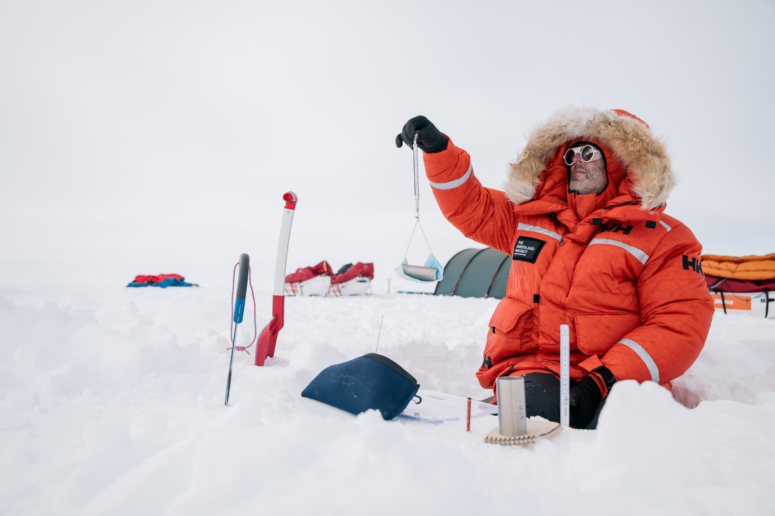
Figure 3. Measuring snow density in a snow pit (image by Heinecke).
Passive Seismic Data
Passive seismic devices essentially listen for noise generated by natural sources; by estimating the velocity that that noise travels through the ice sheet, the thickness of the ice sheet can be estimated. Passive seismic data were collected almost every night at locations shown (Figure 4).
The seismic data are currently examined by University of Leeds and Southern Geoscience.

Figure 4. Passive seismic data locations (pink dots) overlaid over existing estimated ice thickness.
Firn Core Data
One firn core of ~7 m length was retrieved and sampled near the ice sheet summit. These samples will be analysed to determine ice sheet surface composition. The coring/sampling process is shown (Figure 5).
The core data are currently examined by Arctic University.

Figure 5. Conduct of firn core drilling/sampling (image by Heinecke).